Juan Herrera
WMAL.com
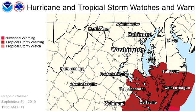
WASHINGTON (WMAL) – As Hurricane Dorian continues to hit the east coast, local areas near the southern Chesapeake Bay and southeast Virginia are soon expected to see strong storms and dangerous winds.
On Thursday, the National Weather Service upgraded the tropical storm watch for St. Mary’s County and adjacent marine areas to a tropical storm warning.
“We’re expecting winds up to tropical storm force for St. Mary’s County and the surrounding waters and then further south and east into Maryland along the coast,” said Cody Ledbetter, a meteorologist for the National Weather Service. “They’re closer to the center of the storm so they’re expecting the higher winds down that way.”
The National Weather Service said portions of southeast Virginia and the southern Chesapeake Bay could expect to see life-threatening storm surge and dangerous winds, along with increased water levels and an increased risk of flash flooding from Thursday into Friday.
Aside from isolated showers and some gusty winds, the immediate DC Metro area isn’t expected to see much of an impact from the hurricane.
“It’s going to stay well to the south and east,” Ledbetter said. “Really the only thing we’re going to see from it primarily is just high clouds; we might see some isolated showers.”
Copyright 2019 by WMAL.com. All Rights Reserved. PHOTO: National Weather Service


")


